 Daily Stormer The Most Censored Publication in History
NEW from me: A Guardian analysis of satellite imagery of northern Gaza in the aftermath of heavy bombardments show more than 1,000 craters visible within 10 sq km.
One residential area 0.5km sq has been bombed over 100 times. #Israel #Gaza https://t.co/iyCmr9Yg4t— Dr. Manisha Ganguly (@manisha_bot) November 4, 2023
🇮🇱 Israeli terrorists just BOMBED ANOTHER SCHOOL in Gaza! pic.twitter.com/4nnbteeRHj
— The Saviour (@stairwayto3dom) November 4, 2023
The Israeli occupation bombs and destroys Al-Azhar University in Al-Mughraqa in Gaza, continuing its war crimes against humanity.
The Israeli occupation’s hatred targets everything in Gaza; school, universities, hospitals, churches, mosques, and organizations all being bombed. pic.twitter.com/n6hMlFLGhV— Birzeit University (@BirzeitU) November 4, 2023
If all these dead schoolchildren didn’t want to end up as filler, then they shouldn’t have died on Filler Sunday.
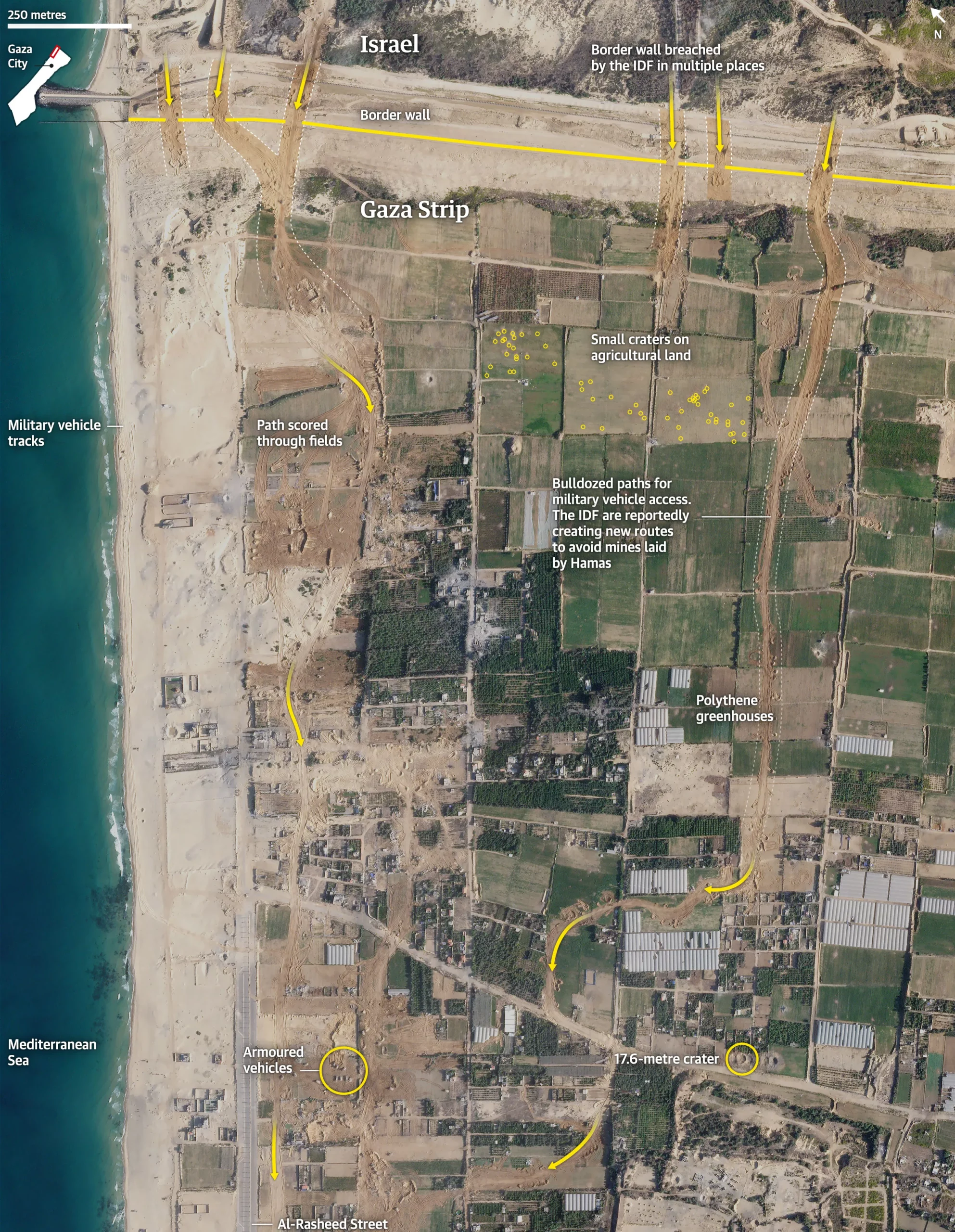
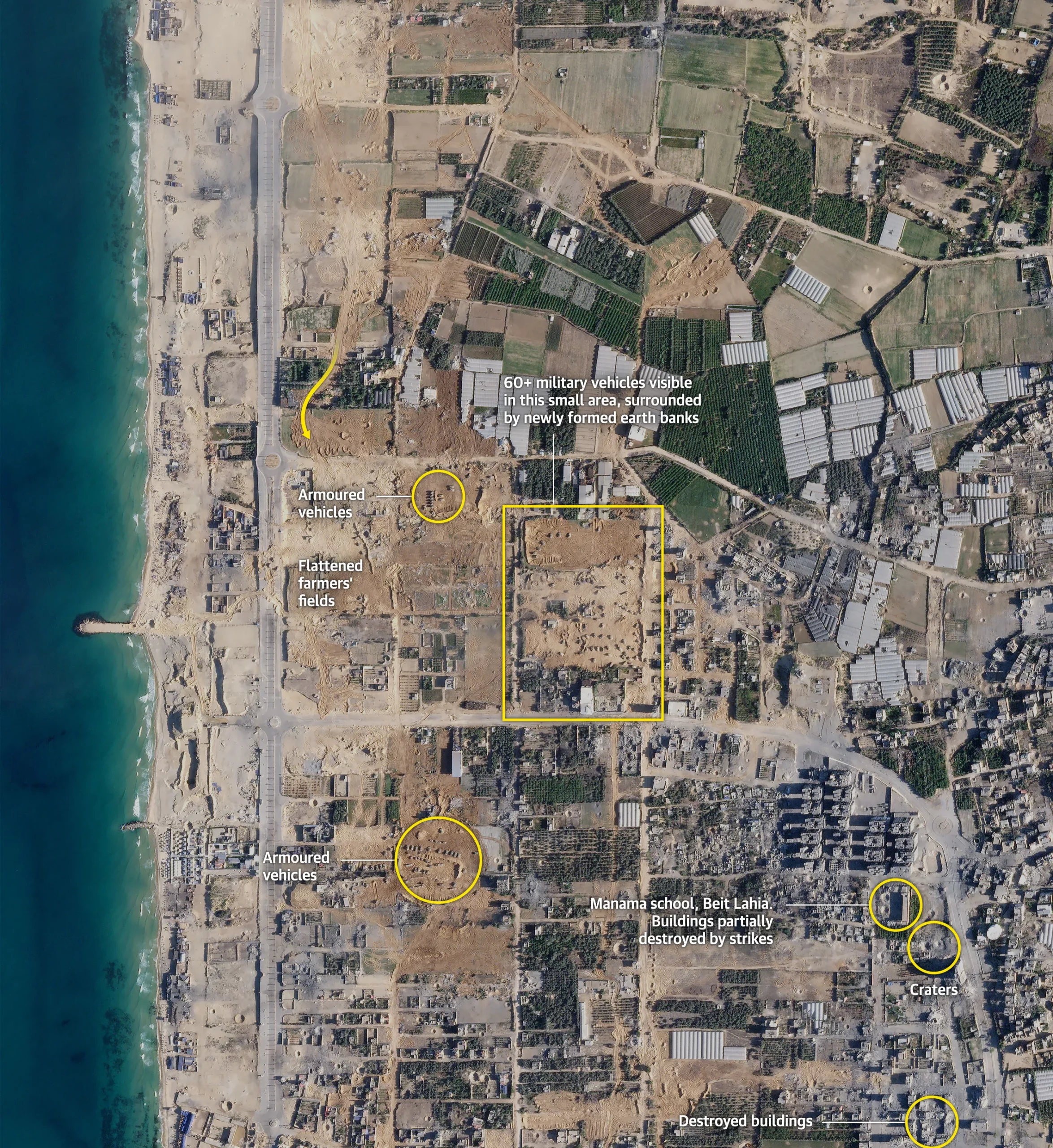
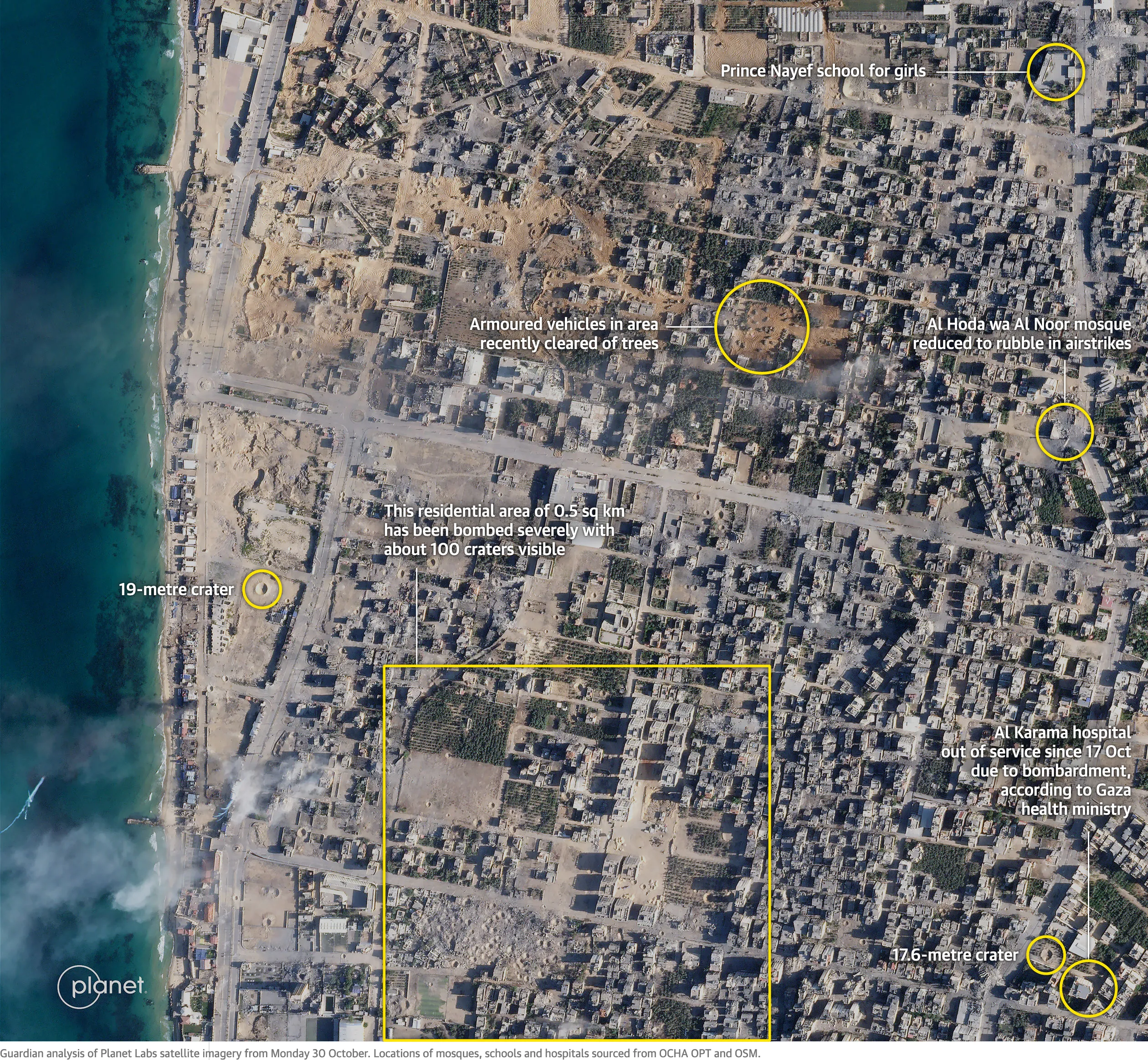
A Guardian analysis of satellite imagery of the northern Gaza Strip in the aftermath of heavy bombardments has identified more than 1,000 craters visible from space within approximately 10 square kilometres.
In one area – just half a kilometre wide – a group of residential blocks has been bombed so severely that about 100 craters, some as large as 45ft (13.9m), are visible.
At least one hospital and three schools in the area have been rendered out of service, apparently due to a nearby bombing. Other buildings in the image, taken on 30 October, have been levelled entirely and reduced to rubble.
…
More than 200 schools have been damaged – about 40% of the total number of schools in the Gaza Strip – about 40 of them very seriously, according to the UN Children’s Fund.
Seriously though, I’ve written a lot about the Jewish Murder Machine.
And I’m going to write a lot more.
But today is Filler Sunday.
Plus, the whole point of the news item is these photos:
A pair of siblings in Gaza City found their brother on Monday while searching for family members among the injured at the Bureij Refugee Camp. Many came to the camp following Israeli airstrikes nearby. pic.twitter.com/Osp7JJhnUF
— CBS News (@CBSNews) November 4, 2023
What, am I supposed to be pretending to be one of the fake writers right now?
Yeah.
Well.
Should I go back and edit it and refer to myself in the third person?
Nah.
Fuck it.